Please read the previous post first:
How Does Fire Affect Butterflies?
 |
| Heading north on Highway 97, this is the southern-most reach of the fire, closest to Ellensburg. |
 |
| North on Highway 97, one of several places where the fire jumped the road. |
 |
| Red fire retardant still stains the highway. |
 |
| The property of a couple my dad knows, who lost their mobile home and shop. |
 |
| One of many close-calls, where a home was saved. |
 |
| New poles along Bettas Road, where the old ones burned down. |
 |
| Parts of the guard rail along Bettas Road were burned where the fire crossed the road. |
 |
| Large portion of the guard rail posts burned here. |
 |
| Looking north from Bettas Road |
 |
| One of the 51 homes that burned, this one is on Bettas Road. |
 |
| A new house going up that was spared from the fire (incidentally my dad is going to roof this one) |
 |
| Looking southwest, back towards Bettas Road (through the valley) from Highway 97. The red house on the hill is the one seen in several news articles, showing the fire burning around it and everyone was surprised when it survived. |
 |
| Another view of the valley. |
 |
| This is just north of the previous two photos, showing the red fire retardant dropped along the ridge. |
 |
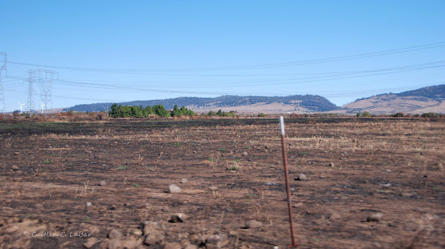
| Scorched area along Highway 97 |
 |
| New pole (left) and burned area along Highway 97 |
 |
| Burned bridge leading to the home in the previous photo. |
 |
| View from Smithson Road east of Highway 97, showing the burned ridge. Click on this photo to view full-size. |
 |
| Burned area along Lower Green Canyon Road, south of Reecer Creek Road. Click on this photo to view full-size. |
 |
| Corner of Lower Green Canyon Road and Reecer Creek Road. Click on this photo to view full-size. |
 |
| View of the burned area from the southbound I-5 viewpoint on Manastash Ridge. Click on this photo to view full-size. |
 |
| Close-up of the eastern-most reach of the fire. Click on this photo to view full-size. |


